Jim Bentley’s memoirs Part 1 The farming year at Manor Farm, Thurgarton.


Jim Bentley was the youngest of seven children whose parents, Ernest and Ida Bentley, farmed Manor Farm in Thurgarton.

Jim Bentley between his parents with Philip, John, Ernest, Hilda, Rene and Mary -taken on Ernest’s 21st birthday.

bentley family

 Jim’s memoirs of his early life in Thurgarton provide us with a first hand account of farming and village life from the 1920s to the end of World War 2. They extend to thirty close typed pages and fall naturally into four sections :-    1) a record of the farming year, 2)  life in the farmhouse,  3) life in the  the village and 4) memories of World War 2   His memoirs will be presented in these four parts with some minor editing. The photographs have been kindly provided by his sister Mary and by Brenda Allwood whose family ran the neighbouring Priory Farm.

Part 1 – The farming year at Manor Farm, Thurgarton 

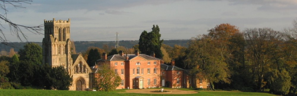
Manor Farm was rented from Trinity College, Cambridge by our grandfather, Robert Bentley, around 1900 after moving from Park Farm, Woodborough. Ernest Bentley, our dad, took it over prior to the outbreak of the First World War: he was helped by his two brothers, Robert and John. Robert was killed in 1915, aged twenty-five, at Thurgarton blacksmith shop by one of the farm horses – Prince.  John William Bentley joined the Rifle Brigade and was killed in 1916 aged 20 at Ypres, Belgium.

Wedding of Jim’s parents -Ida and Ernest Bentley

wedding2 copy

Manor Farm at Thurgarton was a mixed farm of over 300 acres with hay meadows of many luscious grasses and wild flowers, grazing fields and arable land where they grew wheat, barley, oats, rye, clover and silage, potatoes, sugar beet, turnips, mangolds and swedes. During the war rape seed and flax were also grown as well as peas and tick beans for animal feed.

All the fields had names: – The Paddock, Cow Close, The Plot, Little Tylers, Big Tylers, Little Bontibrigg, Big Bontibrig, Rye Close, Ghent’s Field, Bookers, 21 acres, Swales, Bottom Meadow, and several more. Crops were grown in a four year cycle – wheat fist year, clover second year, oats barley or rye third year and in the fourth sugar beet, potatoes, mangolds etc and then it all started again.

Hay time and harvest were the busiest time of the year.  In June the hay meadows were cut in the early morning with a mower drawn by two horses. Later in the day, if the weather was right, the hay was turned by hand or a hay tedder drawn by one horse. In the evening it was either raked by a horse rake or put into swathes by a swathe turner. It was then put into haycocks by hand with a hayfork ready to be loaded onto the wagons and brought to the farmyard and stacked as winter feed for the cattle and horses.

A full hay wagon at Manor farm – Mary Bentley is holding the horse.

mary bentley and father haystack

 August saw the start of corn harvest; wheat, barley, oats and rye, when ripe, were cut by a binder drawn by three horses. Before they could start the field had to be opened up  – enough room for three horses had to be cut by scythe all around the field edge and the corn tied into sheaves by hand. The binder then cut the corn and tied it into sheaves which had to be stooked up by hand, left to dry out and then carted in wagons back to the farmyard and put into corn stacks.

Opening the field –by hand

harvest  by hand 1920s

 These were then thatched for protection against the winter weather. Before the binder a Sail Reaper, drawn by horses, was used; this only cut the corn into swathes, it didn’t tie it into sheaves. Years later the combine harvester took over.

Sail reaper on Priory Farm (Mr Allwood)

allwwod  harvest reaper 1920s

 Autumn was also a very busy time. The fruit in the orchard- apples, pears, damsons and plums all had to be picked. In the fields potatoes were dug out by a potato spinner and then picked by hand into buckets, loaded into carts and then sorted and stored. Likewise the sugar beet, turnips, swedes and mangolds were picked by hand and carted off and stored before winter. Kale was also grown and cut as required.

During winter threshing days came round which meant a job for everyone.  Peter Massey and his two brothers, Matt and Philip, would arrive with their steam traction engine, threshing machine or drum, straw elevator (picker), straw chopper or trusser depending on which type of straw you required. One corn stack per day was threshed. There were lots of rats and mice and that’s where the cats and dogs came in. You had to tie your trouser bottoms up if you didn’t want a rat or mouse running up your leg- it did happen sometimes.

The threshing machine consisted of about 12 men and boys – two or three on the corn stack; two on the drum one who cut the binder string and the other to feed the sheaves into the drum; two or three on the corn stack; one to tie off and weigh the sacks of corn; one to remove the chaff; one to carry water to the steam engine; and one to mind the engine and keep the coal fired up – all in all it was dusty noisy hard work. Several visits were made to the farm by the threshing set during autumn, winter and spring until all the corn in the Dutch barn, in the farmyard and in the fields was gone; usually about 25 stacks in all each year.

Livestock

There were six working horses, Clydesdales, six young horses, colts and fillies; two bred each year on the farm. The horses had names – Bonny, Flower, Blossom, Prince, Duke, smart, Violet, Beauty, Jewel, jubilee, tinker, gypsy, Nettle, daisy and Bouncer are just some of the names I remember; these gentle giants worked the farm for over fifty years.

Bonny, Blossom and Flower on Manor Farm, Thurgarton  1927

Bonny, Blossom & Flower Aug bank holiday 1927

Ploughing match at Thurgarton – Mr Allwood, Priory Farm

allwood  ploughing match

 There were twelve to fourteen milking cows, Lincolnshire Reds, and about a dozen calves were reared at any one time; also about fifty beef cattle – Aberdeen Angus, with a Leicester Red and an Aberdeen Angus bull for breeding. We also kept half a dozen large white pigs for breeding, around a hundred Border Leicester ewes with a Hampshire ram, fifty Rhode Island Red hens, two Collie dogs and ten cats made up the remainder of our animals. The horses and cows were brought in from the fields at 6o’clock in the morning. The horses were fed , groomed and harnassed ready for the day’s work. The cows were fed and milked by hand twice every day, seven days a week and fifty two weeks a year.

Bringing in the cows

cows

 The milk was first put through a sieve or milk sile into a churn. It was then put through a cooler which was a corrugated box with cold water from the well running inside as the milk ran down outside the corrugations into the churns. The churns were collected every morning by Wheldon’s lorry from Nottingham. The milk delivery round the village (about half a dozen houses) was carried in metal cans and measured out in pint and half pints into their jugs – no milk bottles or cartons.

During winter all the animals, except the sheep, were kept in their respective stables, sheds or crew yard which had to be cleaned out twice a day and fresh straw put down. The sheep were kept near the farm buildings and had hay or straw stacks for shelter in winter. It was one long battle in winter to keep the animals contented but come the spring when they were all let out again into the fields, they would all hop skip and jump, happy to be free once more.

In the late spring, after lambing time, the sheep had to be sheared of their wool. In summer they were dipped to prevent ticks and maggots and to prevent foot rot their hooves were trimmed with a knife.

Sheep shearing on Priory Farm (Mr Allwood)sheep shearing Allwood s  Priory farm

Every year we killed a pig for our own use; it didn’t seem right to me to fuss and spoil a pig to fatten it up and then kill it. I hated to hear the squeals of the dying pig – no stun guns in those days. It made a lot of work with sausages to make, pork pies, pigs fry and chitterlings. Sides of bacon and hams were salted then hung on hooks in the kitchen to dry out before being stored away – no refrigerators. 

All had to be done in one day but the end result was enjoyed by all. They said that the only part of the pig that was wasted was the squeal- the trotters, ears, snout, tail and brains were all used, as was the head. A plate of pigs fry, sausage or chitterlings was taken to each of the old people of the village.

Horsepower and machines

Bringing the loaded wagons down Thurgarton Hill was always a bit of a trauma. You had to stop at the top of the hill and scotch one of the rear wagon wheels with a drag or slipper which prevented the wheel from turning and the wagon wouldn’t overrun the two horses – the one in the shafts and the other trace or gear horse. At the bottom of the hill the slipper, which had become red hot, had to be removed without burning your fingers.

A most pleasant sight in the village was the timber wagons which came from Nottingham to haul tree trunks from the woods and farms. They were pulled by up to eight Clydesdales, depending on the size of the tree trunks, and to watch them passing through the village was a lovely sight. 

Tree felling, Thurgarton 1912

treefelling  landlord coach +horses in bowler hat mr fletcher

The first tractor we had was an old International with iron wheels; as well as cultivating and ploughing it was also used for driving a saw bench when cutting logs for winter. Just before World War 2 it was replaced by a Case tractor which had iron lugs on the wheels later converted to rubber tyres. One of its many tasks was to drive the silage machine which chopped up the silage and blew it up the long pipes on the outside of the silo (about 100ft) onto the top of the silo. Inside the silo about a dozen of us had to tread down the silage to pack it tight. We wore sacks over our heads and it wasn’t unusual to get hit on the head with the occasional stone. If you were picked to go into the silo you knew you were ‘ grown up’. It was a very dirty noisy job.

The first rubber- tyred cart we had on the farm was collected by me from Arnold Lodge Farm (Archie Huckerby’s farm) during the war. I had to take Jewel, a quiet gentle strawberry roan; we took a hay tedder from Thurgarton to Arnold and collected the rubber- tyred cart and brought it back to Manor Farm.

Autumn time and the ploughing season sometimes saw the steam cultivator engines. Two large Fowler engines stood on either side of the field and pulled an immense plough (eight furrows) to and fro. A steel rope was wound round a horizontal drum positioned below the boiler. An eight furrow plough could work eight acres in about five hours.

Jobs for all the family

Every morning before school there were jobs to be done – sticks, coal and logs to collect, milk to deliver in the village, the dogs to feed. After school there were mangolds to cut up and mixed with straw to feed the cattle; clover and hay to chop up for the horses , eggs to collect, the cows to bring in from the fields for milking, the horses to turn out into the fields after their days work, water to pump by hand for the animals, slabs of linseed and cotton cake to be crushed in a cake breaker and also the garden and lawn to look after – there was never a dull moment.

When not at school we picked up stones in the hay and corn fields before cutting commenced to prevent damage to the mower or binder blades. Also weeding out large weeds (fat hens) from the corn and root crops, singling out sugar beet, turnips, mangolds, kale and swedes and keeping the birds away from newly sewn seed with a pair of clappers similar to the ones one sees at football matches

Jobs for 12-14 year olds involved harnessing the horses with collars, bridles, saddle, breech band and reins and then taking the wagons out to the fields and bring back the loads of hay or corn to the farm – a round trip of up to 2 miles. Other jobs included hoeing, turning hay, harrowing with chain harrows, and rolling the corn and grass fields with a flat or Cambridge roller. After driving horses and wagons all day until nearly 11 o’clock at night in the summer months (even later with Double Summer Time in the war) you didn’t need much rocking to sleep.

Jobs for all ages

harvest 1953 frank allwood and son

The lost village of Horsepool.

Somewhere in the parish of Thurgarton is the lost village of Horsepool. The Victoria County History of Nottinghamshire claimed that it lay 1 mile to the north of Thurgarton village but other evidence points firmly to the south of the parish close to the River Trent  (1) .  The earliest mention of Horsepool in Domesday includes it within the vill of Thurgarton  but provides no clue to its size or location.

The main written source for Horsepool can be found in the Register or Cartulary of Thurgarton Priory where several charters of land grants in Horsepool are recorded from the 12th and 13th centuries (2) .  These charters  include many of the field names of Horsepool some of which survived into 18th century parish surveys and  maps. One such field, Dunsbriggefurlong, lay in the south-western corner of the parish next to Hoveringham. The fields of Horsepool appear to have  occupied the southern part of modern Thurgarton parish and lay between Hoveringham and Gibsmere.

Fig 1 Fields of Horsepool in south of Thurgarton parish (white) – Thurgarton village – green, Horsepool fields -blue, old road -red.

horsepool location

One of the Horsepool charters refers to a toft (cottage) and the wall of a grange which were located close to ‘the king’s highway’ (4). The king’s way referred to is the bridle road which was one of the main routes from Nottingham to Newark. The road appears on all the early parish maps and ran from Hoveringham Mill ( here it was called Milngate) across the southernmost fields of Thurgarton parish and onto Gibsmere and the Trent crossing at Hazelford.  Horsepool evidently lay alongside this road most of which is now merely a footpath but parts of the original wide trackway survive.

Fig 2 Old road towards Gibsmere

road to hazleford

In 1328 a survey of the lands of Thurgarton Priory mentions John Criol’s hall in Horsepool; Hall field was a large field which bordered Hoveringham and the name suggests this may have been the site of his hall. The Criols (or Kiriolls) appear to have been the main landowners in Horsepool; initially they were probably subtenants of the Dayncourt barons who were Lords of the Manor of Thurgarton but by the 14th century much of Horsepool belonged to Thurgarton Priory to which the Criols made several gifts of land (5).

The  Horsepool charters  refer to cottages, gardens, a barn and closes but only seven householders were identified in the the 1328 survey of Thurgarton Priory (compared with over 60 householders in  Thurgarton), suggesting that Horsepool was a small community. One can picture a hamlet close to the Criol’s hall or grange lying alongside the old road  – in character and size somewhat similar to its near neighbour, Gibsmere, in Bleasby parish.

Sadly any vestige of Horsepool’s cottages, walls or hall has been obliterated by extensive gravel extracton in the 1950-60s; every field in the parish south of the railway line was excavated. Some aerial photos however were taken before the gravel extraction; in figure 3 below, a possible trackway surrounded by humps and cropmarks can be seen with the eye of faith in the field adjacent to Coneygree farm.

Fig 3 Aerial photo 1948 showing Coneygree farm and with possible trackway (red dots), cropmarks and humps in field (6).

humps and bumps

In 1949 these features came to the attention of local archaeologists. They reported a sunken trackway next to several  humps some nearly 30 ft  across; excavation of one of these humps revealed a scatter of skerry stone and mediaeval pottery. Although no definite remains of houses etc were uncovered they concluded with suprising confidence that ‘ these humps are the remains of the long lost village of Horspol’ (7). Their OS grid reference for this site places it just south-east of Coneygree Farm. In 1961 close to the above location  an old  well and further mediaeval pottery were uncovered. All of this site was subject to gravel extraction – if this was Horsepool it now lies 40ft down.

Deserted Mediaeval Villages.

Deserted Mediaeval Villages (DMVs) hold an especial interest for local historians who popularised this area of study 60 years ago. The list of such deserted sites has increased to many thousands and  they raise the obvious question  as to why such villages disappeared from the landscape;  their study however has  revealed not only why villages died but also how they were born, grew, shrank and shifted in the landscape (8).

There is no single cause for the death of these villages. The Black Death would undoubtedly have depopulated most communities and rendered some nonviable but many survived this catastrophe; some succumbed to land enclosure, others disappeared in the planning of new country houses and parkland, some were swallowed up in industrial expansion, new reservoirs, natural disasters etc- the list of causes is a long one (9).

Horsepool certainly survived the Black Death.  The last reference to Horsepool Grange is  in 1539 on the sale of Thurgarton Priory land to William Cooper. Later surveys of Thurgarton merely refer to the fields of Horsepool and no mention is made of tofts, barns or hall. The grounds of Horsepool are recorded in the 1730 survey and map of Trinity College estate in Thurgarton.; they  lie just across the border in Gibsmere close to Glebe Farm, which has recently been renamed Horsepool Grange.

Fig 4 Horsepool Grange, Gibsmere

grange farm

 Horsepool’s demise seems to date to the 16th or 17th century but the estate records give no indication of exactly when and why it disappeared. It was owned by Trinity College Cambridge who leased their lands to several generations of the local squires – the Cooper family. Estate improvement with enclosure is a possibility but so is repeated flooding from the Trent – we can only speculate.

The mediaeval charters and surveys name several of the Horsepool folk – Margery the widow of William Frauncey, Thomas the Pinder, Richard Petrich, Richard Willan, Wiiliam Asger and several generations of  Criols. Some would have adopted the name Horsepool as their family name – a not uncommon surname in this area.


References

1 Victoria County History of Nottinghamshire, vol.1, p.273

 2 T.Foulds, The Thurgarton Cartulary, (Stamford, 1994)  pp.31-45


3 Nottinghamshire Archives Office , maps M12612, M12613 and T. Foulds, map 2


4 Foulds p.32


5 ibid p. 658


6 Aerial photograph NMR Swindon 541/111 (3142), 27 th July 48


7 H.O. Houldsworth, Peveril Archaeology Group, Annual Report 1949. pp.11-2.


8  M.W.Beresford, The lost villages of England, (London, 1954)


9 C.Dyer, R,Jones (eds.) Deserted Villages Revisited, (Hatfield, 2010)

Images of Thurgarton – before the motor

The main road through Thurgarton (the A612) is nowadays a busy highway and pedestrians attempting to cross  can grow old waiting for a gap in the traffic. The photographs and postcards below take us back to late Victorian and Edwardian Thurgarton.

A time when —

 — children could play in the middle of the road

3

— and a farm lad could take his time driving a cow down the highway.


A time when horse drawn carts travelled at walking pace although a pony and trap could travel at a fair lick especially coming down the hill — 

— but going up Thurgarton Hill, which was much steeper in those days, one had to pace oneself.

It was advisable to take  refreshment before starting the climb at The Coach and Horses —

– – or stop halfway up at the Red Lion

— and if one  had over refreshed and suffered a breakdown then simply roll back down to the  smithy at the crossroads.

The earliest map of Thurgarton: land use in the parish

The earliest parish maps of Thurgarton were drawn up about 1730 to settle a land ownership dispute between Trinity College, Cambridge and the Cooper family.

The Coopers owned most of the north of the parish and lived in a Tudor mansion next to the parish church. In 1726 a rough sketch of the Cooper lands showed fields, woods and lanes (blue in map 1); their land was chiefly low hilly country of heavy clay soil extending down to the escarpment of the Trent Valley. They also leased much of the Trinity College land and acted as Lords of the Manor.

Trinity College Cambridge had been granted the village and southern half of the parish by Henry VIII. The 1731 map of Trinity College land (white in map 1) included not only village buildings, gardens, fields and lanes but also the names of each householder and the land that they rented from the college

Combining these two maps provides us with the only detailed pre-enclosure map of Thurgarton parish.

Map 1 Thurgarton parish c 1730 ( click on image to enlarge)

parish early 1730

Land usage in Thurgarton

The field names and layout provide some insight into land usage not only in 1730 but also for the preceding centuries for many of these 18th century field names can be traced back to the early Norman period in the land grants of the register or cartulary of Thurgarton Priory indicating that the basic pattern of land usage in the parish had not changed for at least 500 years.

Map 2  Basic land use in Thurgarton parish  (click on image to enlarge)

land usage


 1 Wooded parkland in the north (green in map2) – Overwood, Bankwood, Parkwood, Southwood, Youngwood.

A park at Thurgarton was part of the endowment grant by Ralph Dayncourt to Thurgarton Priory which he founded in c 1130. This was probably a deer park and sections of a ditch and bank , remnants of a possible deer fence and  a deer leap, can still be seen on the northern boundary of the parish.

In 1536 the Prior of Thurgarton sold timber from ‘his park at Thurgarton’ to the Duke of Rutland to rebuild Belvoir Castle. The contract describes the extent of the park which appears to have covered most of the north of parish and was evidently heavily wooded given the size of the timber contract – 1200 large oaks over 10 years.

Mediaeval wooded parkland was a valuable asset and besides hunting and timber it also was a source of fuel for domestic hearths and for small scale industrial furnaces; charcoal and tile making are both recorded in Thurgarton. In winter fodder for livestock included woodland leaves and pigs were allowed to  forage for acorns and roots. The villagers collected woodland plants and berries to supplement their diet or for medicinal use.

‘The Park’ persists in modern Thurgarton but has shrunk to an area of new houses and adjacent fields to the west of the church.


 2 Assart ( yellow in map 2) –Thwaite, Intake and Riddings

These names are typical of woodland which has been cleared for ploughing

(assarting) and which would have been incorporated into the open field system described below. These fields are named in mid-13th century land grants to the Priory which would be consistent with the increasing village population of this period and consquent need for more arable land. The mediaeval method of ploughing with ox teams along narrow strips of land gave rise to the typical  ridge and furrow patterns which have survived in many lowland parishes of Britain and are visible on field walking or in aerial photographs.


 3 Arable open fields ( brown in map 2) – Great field, Over field, Spital field.

These arable strips of plough land surround the village and lie on the well draining escarpment land. The land strips (selions) are clearly seen on the Trinity map (map 3) and aerial photos clearly show ridge and furrow patterns for Great Field and the assarted fields above.

 Map 3 Trinity estate with arable strips coloured in two tone green 1730 arable strips

 The pattern of arable fields is consistent with a three or four field rotational system of land use in the parish. Again several of these small strips of ploughland are mentioned in land grants to the Priory in the 13th century and earlier.

4 Pasture and meadow ( blue in map 2)- Nether Leys, Nether Meadow

The wet valley floor provided ideal pasture land and hay meadows and numerous small closes for livestock. Records indicate rearing of pigs, cattle and sheep and the name Coneygree indicates a rabbit warren (much prized by the early Norman lords and by modern Frenchmen ).

  Village plots and householders

  The village was owned by Trinity College and so appears on the college map.

Map4 Trinity College estate in Thurgarton, village highlighted.
1730 vill highlight copy

In this map houses and barns were denoted by letters ‘H’and ‘B’ ; in map 6 below the houses are in red, barns and outbuildings in brown, the school in orange and alms houses pink.

Map 6 Thurgarton village c 1730 ( click on image to enlarge)1731 village houses in red

 There were 27 named householders each with their house and outbuildings set in typically elongated plots of land – the croft.  Each householder is listed in map 7 below with a colour code for their corresponding house and croft.

Map7  Village plots with householder1730 villagers colour code 2The map also identifies the fields worked by each villager; they are shown in map 8 using the same colour code as in Map 7 above

Map 8 Land worked by each householder  – colour code as in map 7.

1731  16 small holders copy

 Each householder worked several widely seperated fields and strips of ploughland. This is more clearly seen if we simply look at one individual – John Brettle ( misspelt Bretton on the original map)

Map 9 Village plot and fields rented by John Brettle

1731 1 J brettle copy

 Thurgarton was a typical East Midlands parish with a single centrally positioned village surrounded by three or four large open fields worked on a yearly rotation system which would have been closely supervised by the villagers in their local Manorial Court. The parish stretched from wooded upland in the north to the well drained fertile escarpment on which stood the village and on to the the river valley with its pastures and meadows – an ideal balance of woodland, arable and pasture making the parish almost self-suffient for most of its needs.


This ancient pattern of land usage by the village community was to change dramatically before the end of the 18th century when  enclosure came to the parish  and will be the subject of another article.


The Civil War and Thurgarton

When Charles I raised his standard in Nottingham on 22nd August 1642, men of property and influence were forced to choose between supporting Parliament or their King.           In Nottinghamshire most of the landowning gentry were staunch royalists including Sir Roger Cooper of Thurgarton who lived at Thurgarton Priory, a Tudor house built by his great grandfather on the remains of a partially demolished Augustinian Priory.

1632 tapestry map showing Tudor house at Thurgarton (1) .

tapestry map

Sir Roger was a magistrate and in 1639 when High Sheriff of Nottinghamshire was responsible for the collection of the increasingly unpopular taxes levied by the court – Ship Money  and Coat and Conduct Tax. Increasing numbers of tax defaulters were recorded in the county records of the 1630s including the entire townsfolk of Newark who withheld payment.

In the 17th century county affairs were controlled by the gentry who owed their appointments to the crown. The gentry in turn appointed village officers who ran parish business. The Protestation Returns of 1641 for Thurgarton lists 66 male householders  and identifies Michael Poyser as Constable , Matthew Brettle and Henry Forrest as Churchwardens, William Holmes and Thomas Turvey as Overseers of the Poor  and Zachariah Trigg as Minister. The fortune of the village in the ensuing conflict would depend on such men of standing in the community but most of all on Sir Roger and his choices.

Civil War in Nottinghamshire

A few months after the outbreak of civil war the royalists garrisoned and fortified Newark which gave them control of vital road and river routes; the town proved to be one of the main centres of royalist strength throughout the war. Less than 20 miles away the parliamentarians, under Colonel Hutchinson, took control of Nottingham and its castle.

Sir Roger Cooper fortified his house and stables at Thurgarton; and similar garrisons were established at Wiverton, Newstead, Shelford, Belvoir Castle and Staunton so providing a screen of royalist outposts around Newark.

Royalist garrisons in red.

Caught between the Royalists in Newark and the Parliamentarians in Nottingham, life in the intervening villages such as Thurgarton was dominated by the competing needs of both armies for manpower, horses, transport, food, fodder, and arms. Village constables continued to raise taxes imposed by whichever side controlled their district and with the fluctuating fortunes of the war some villages found themselves supplying alternating sides or worse were plundered if they had been too supportive of the opposition. In garrison villages and towns the troops were billeted on the locals so further stretching local supplies(2). Occasionally foraging parties could be diverted from their duty as were Colonel Harper’s men who were persuaded not to seize horses from Thurgarton by the provision of 2s 6d of ale.

The royalists at Newark dominated most of the county in the early years of the war and launched a number of attacks on Nottingham; in September 1643 they came close to overrunning the town driving the parliamentarians troops into their last redoubt – the castle (3). In 1644 the tide of war turned and  Parliament with their Scottish allies took control of the North.  Newark became a target for repeated parliamentary attacks but held out to the final days of the war.

Trouble at Thurgarton

One abortive attempt to take Newark late in 1644 started with an attack on the small royalist force at Thurgarton. This account is taken from the memoirs of Lucy Hutchinson wife of Colonel Hutchinson the parliamentary Governor of Nottingham (4).  Parliament ordered “ all the horse of Nottingham and Derbyshire to join with three regiments of Yorkshire and quarter about Newark to straighten the enemy there; and accordingly  they rendezvoused at Mansfield and from thence to Thurgarton where Sir Roger Cooper had fortified his house and lined the hedges with musketeers who, as the troops passed by, shot and killed one Captain Heywood, whereupon Colonel Thornhagh sent to the Governor and desired to borrow some foot to take the house. The Governor accordingly  lent him three companies of foot who took the house and Sir Roger Cooper and his brother and forty men in it who were sent prisoners to Nottingham ; where , although Sir Roger Cooper was in great dread of being put into the Governor’s hands, yet he received such a civil treatment from him that he seemed to be much moved and melted at it.’

1726 Buck’s print of Thurgarton Priory and church

After taking Thurgarton the parliamentary foot and cavalry marched to Southwell where dissension broke out between the foot soldiers who had done most of the fighting at Thurgarton and the cavalry who had confiscated all the plunder taken there.  The Nottinghamshire horse harassed the surrounding countryside but were poorly disciplined and failed to set a night guard. A royalist foray from Newark ‘ beat up their quarters’ and captured two troops of parliamentary horse and so this particular threat to Newark melted away.

Thurgarton was plundered and the surrounding countryside was ‘ miserably distressed’ . Thoroton ‘s history of Nottinghamshire mentions the damage done at Thurgarton  ‘the woods being also extremely wasted’ (5). The winter of 1644/5 must have been an especially hard time for the villagers.

Local lore claims that a mass grave of men and weapons was unearthed in a sheepfold near Magadales Farm and an old stunted elm tree near the priory was said to have been cut in half by Cromwell’s cannon. What is certain is that musket balls can be found in the gardens next to Castle Hill.

Musket balls from Castle Hill

In May 1646 Charles Stuart surrendered to the Scots army at Kelham and a sort of peace was restored to the country.

Sir Roger Cooper recovers his estate

Late in 1646 Sir Roger Cooper was evidently a free man and spent much of the following year in London attempting to recover his estate which had been confiscated by Parliament. Many hundreds of fellow royalists faced this same dilemma and were required to pay enormous fines to regain their property. Sir Roger was in correspondence with Dr Huntingdon Plumtree a physician and one of the parliamentary committee who had controlled Nottingham during the war. Huntingdon, an avowed atheist with an acerbic wit, was one of the faction within Nottingham who had plagued Governor Hutchinson and provoked severe censure in Lucy Hutchinson’s memoirs (6).

The tone of the letters between Cooper and Plumtree was friendly and Cooper was evidently being financed by the good doctor. Sir Roger apologised for the prolonged delays in his business due to long queues at Guildhall where the Parliamentary Compounders worked slowly through long lists of royalists.He requests more money for his expenses for he was not allowed to collect the tithes and rents from his estate(7). Eventually Sir Roger was fined £2,256 by Parliament and to meet this enormous penalty he sold his land and property in Fiskerton, Morton and Bleasby (including Ashwell Hall) to Dr Plumtree for almost the same amount of money as his delinquency fine – £2,250 (8). However that was not the end of Sir Roger’s financial troubles for Parliament demanded another £1200 before he was allowed to repossess his property; this was reduced on appeal in 1651 to £270 by which time he had mortgaged his estate for £8000. He died in debt as did his son John

Second Civil War

In 1648 Charles 1 escaped and allied himself with the Scots whose relations with the English Parliament had deteriorated into open warfare. In 1648  a Scots army  marched down into Lancashire but in mid August the parliament’s army overwhelmed the Scots at Preston. Amongst several abortive royalist uprisings in 1648  a force of  400 horse and 200 foot soldiers marched from Pontefract to Lincoln and on towards the vale of Belvoir. On 5th July 1648 a parliamentarian force led by Col. Rossiter defeated the royalists after 2-3 hours of bloody hand-to-hand combat at Willoughby. Casualties were severe and amongst the royalist prisoners were John and Cecil Cooper, sons of Sir Roger Cooper of Thurgarton. How long they were held captive is not known but both were again at liberty in the early 1650s.

The Commonwealth and Protectorate

Charles Stuart the ‘man of blood’ was found guilty of treason and executed at Whitehall on January 30th 1649. The following four years saw a confused struggle for power between the Army and Parliament until Cromwell imposed his rule as Lord Protector in 1653 until his death 5 years later.

Execution of Charles I

beheading018

 In 1655 a group of royalists formed a secret committee – the Sealed Knot. In collusion with the future Charles II in exile in the Low Countries, they planned a series of  royalist uprising; plans for Chester, Lincolnshire, and Yorkshire all came to nothing and in Cornwall Penruddock’s rebellion was rapidly crushed.  In Nottinghamshire a planned uprising involved Sir Roger Cooper’s sons, John and Cecil who were ringleaders in the plot. They mustered a small force of men and a cartload of weapons at Thurgarton; according to local versions of the story they met at the remote farm of Thurgarton Quarters which lay on the route northwards to Oxton and Sherwood Forest.

Thurgarton Quarters farm lies in the north of the parish on the road to Sherwood Forest

Thurgarton quarters farm copy

Here is Wood’s description of these events in March 1655:- ‘Late on Thursday night March 8th little files of horsemen threaded their way along the dark lanes of Sherwood Forest to the appointed rendezvous on the green before the New Inn close to Rufford Abbey and the cart of arms was brought from Thurgarton. By 11pm about 300 royalist conspirators had assembled. The two Cooper brothers, Gilby, Barker and the other gentlemen went into the inn to discuss their plans while their followers waited on the green outside. At midnight or a little later Captain John Cooper came out, and telling the assembly that they were betrayed, he bade every man to shift for himself. On Cooper’s announcement some of the men flung their arms into the neighbouring pond and the meeting rapidly melted away into the darkness’ (9).

The intention had been for the Rufford assembly to join forces with a similar body of Yorkshire royalists and march north to seize York. Both Cooper brothers were arrested, Cecil Cooper was permitted to leave England  and brother John eventually escaped and fled overseas probably to join the circle of royalist exiles in the Low Countries.

The Restoration

Sir Roger Cooper died in 1657. His younger son, John,  was still in exile and in 1658 John Cooper’s wife, Jane,  wrote to Richard Cromwell the new Protector begging permission for her husband to return ‘ that he may live quietly’. We have no record of a reply to this letter but John and Cecil Cooper were probably amongst the host of returning royalist exiles that accompanied Charles II in 1660.


Charles II

Charles II was in no position to financially restore the lost fortunes of his loyal followers many of whom had to content themselves with the royal gift of honorary court appointments – John Cooper was appointed ‘Carver to his Majesty’. Indeed Charles II’s government was short of funds and resorted to a raft of new taxes and  John Cooper as his father before him was resposible for their collection in Nottinghamshire. He was described as ‘ a very industrious person who died in 1672 in his majesties debt having been Receiver General of the Royal Aid and Additional Supply and Collector of Hearth taxes in this county’. His older brother, Cecil Cooper, also returned from exile and served as a magistrate from 1660 to 1674 and as deputy lieutenant of the county; he died in 1675 and was buried in Thurgarton church

Graveslab of Cecil Cooper

cecil cooper grave

Revenge?

With the exception of the regicides most leading parliamentarians escaped severe retribution. Governor Hutchinson’s house at Owthorpe was plundered in December 1660 on the orders of Captain Cecil Cooper possibly in revenge for the despoiling of his father’s estate in Thurgarton six years previously.

Lucy Hutchinson complained bitterly of Captain Cooper’s raid on her home but three years later he redeemed himself by an act of kindness to her imprisoned husband. Hutchinson was initially allowed his liberty but in 1663 he was arrested and imprisoned at Newark prior to his transfer to the Tower. In poor health his transfer was delayed by order of Cecil Cooper and he was allowed a last visit to his family at Owthorpe (10). He died of fever in Sandown Castle in 1664.

Conclusion

The great Nottinghamshire historian,Thoroton, writing only a few years after the Civil War describes Sir Roger Cooper as:‘ a worthy honest gentleman whose fidelity and constancy to the royal interest weakened his fortunes so that Cecil Cooper esquire his son will have too hard a task to make his house and demesnes entirely his own’ (11). The same could have been said of many worthy and honest gentlemen on both sides of the divide. As for the villagers of Thurgarton we have no record of how many shared Sir Roger’s loyalty to the king but what is certain is that they along with the ordinary men and women of England suffered years of hardship.

They were poorly served by both King and Parliament.

References

1 Tapestry Map of Nottinghamshire commissioned by Mary Eyre in 1632 and held at Nottingham City Museums.

2 M.Bennett, The Civil Wars in Britain and Ireland (Blackwell 1997), pp.176-9

3 C:\Documents and Settings\Owner\Desktop\civil war\The Nottinghamshire Heritage      Gateway  Events  The English Civil War  Overview.mht

4 L. Hutchinson, Memoirs of the Life of Colonel Hutchinson (J.M.Dent 1969), pp.190-1.

5 R.Thoroton,  Antiquities of Nottinghamshire1677, edited 1790 by J.Throsby, (reprint 1971 E.P.Publishers)  p.59

6 http:/www.oxforddnb.com/view/article/71045 – biography of Dr Huntingdon Plumtree

7  Nottinhamshire County Archives, DD.2B 2/17-51, letters between Cooper and Plumtree.

8 House of Commons Journal  V 5 : March 9th 1648 and  House of Lords Journal V 10   15th April 1648

9  A.C.Wood, Nottinghamshire in the Civil War, (S.R. Publishers, Wakefield 1971), pp.166-9

10 Hutchinson  pp.302-3

11 Thoroton p.59

Other Sources

M. Ashley, The English Civil War ( Stroud 2001 reprint)

M.Bennett, The Civil Wars Experienced (Routledge 2000)

I. Brown, The Civil War in Nottinghamshire (Notts County Council 2000 reprint)

Copwell, 17th Century Nottinghamshire County Records

A. Fraser, Our Chief of Men (Phoenix 1973)

M.Honeybone, The Vale of Belvoir (Barracuda Books 1987) pp.39-62

Making one’s mark in Elizabethan Thurgarton

The document shown in Figure 1 is kept in the Archives of Trinity College Cambridge. It dates from 1576 and lists all the tenants in Thurgarton who rented land from the College (1).

Figure 1 List of tenants in Thurgarton in 1576tenants 3

All of the village and the southern half of the parish had been granted to the College by Henry VIII  after the dissolution of the Augustinian Priory of St Peter at Thurgarton. At the same time  the Cooper family had purchased the priory buildings and land in the northern half of the parish; they subsequently leased the college land in the parish for many generations.

Over 640 acres were held by 41 tenants; the largest farmed 80 acres but most only 1 to 3 acres. 5 of the tenants were women including Elinor Cooper, the widow of the late Lord of the Manor, Thomas Cooper; she continued as leaseholder of the college lands in Thurgarton after her husband’s death.

Attached to the  document is a second page shown in figure 2 on which is a list of names of 15 tenants alongside their individual marks; each has a separate and distinctive mark.

Figure 2 Fifeteen tenants names alongside their individual marks ( click on image to enlarge)

tenats marks 2

All 15 who made their mark are found in the full list of tenants in the first document and include both large and small landholders but no women; the remaining 26 tenants appear to have consented to a communal mark ” and also done by me with the consent of all the rest”

A transcription of the names with their corresponding marks is shown below.

ten mark 15

There are no duplicate marks and each is distinctive. Two or three may reflect the initial letter of the tenant’s name eg Wiggin and Smalley but the others do not and vary from simple lines and circles to much more elaborate flourishes.

The use of marks to prove one’s identity or proclaim ownership dates from early human history – from marking one’s territory with symbols to branding livestock or slaves. In the mediaeval period even the educated and literate who were able to write their names still employed symbols as proof of their identity – carved rings or matrices which they imprinted  in wax.

The marks we see in these documents from16th century Thurgarton are very different from the usual ‘X’  mark seen in wills and other signed mediaeval documents. Similar symbols are seen in 13th century estate books from Northamptonshire but were used to denote the size of each tenant’s holdings(2). These symbols from Thurgarton  are more reminiscent of those employed by stonemasons, merchants or carpenters and it may be that they were similarly employed to confirm ownership of livestock, agricultural or trade implements, furniture and any moveable item essential to one’s living. They appear to be parish brand marks and were used by all ranks of the parish society from William Wiggin  who held a mere 2-3 acres to John Mayfield who rented 9 acres and Thomas Mawer and John Grundy who rented 40 to 80 acres.

Consultation with both county and national archives have failed to produce similar parish wide use of such symbols; it is possible that such parish marks were in common use but documents such as this one rarely survived. Anyone who knows of similar examples – please contact me.

Note on the Grundy family

John Grundy was mentioned in Thomas Cooper’s will “I give my servant John Grundy the tenement he occupies for his natural life and to his son Michael Grundy and heirs and I give Margery Grundy my Nurse five marks (money) for remembrance as a servant ” In 1614 his son Michael Grundy was refused the style of gentleman by Norroy King of Arms but by 1628 the family was described as :- ‘The Grundies of Bleasby with a coat of arms argent on a cross engrailed between four lions passant gardant gules five marlets or and a crest of four demi-lion rampant gardant sable besanty’

Looking back to the parish marks in the 1576 document that of John Grundy stands out as the most impressive and suggests an ambitious man – his family rose from servant to gentleman in three generations

References

1 Trinity College Cambridge Archives Box 37 Thurgarton Item 16

2 M.T.Clanchy,  From Memory to Written Record England 1066-1307 (Blackwell 1993 ) Plate XV Estate book of Richard Hotot

The stones of Thurgarton

Brick is the main building material of the mid-Trent valley and on sunny days gives a  pleasing glow to the village scene.

Thurgarton in the sunshine.

IMG_0005

In contrast with its neighbouring villages however Thurgarton  also has considerable quantities of stone in its walls, barns, gardens and older buildings.

Coach and Horses, Thurgarton built mainly of skerry stone.

Most of this stone is local skerry stone which has a grey cut surface that varies from flakey lamina when cut across the grain and whirling patterns when en face.

The geological map below reveals an abundance of skerry stone in the hills of the northern half of the parish – the bands of skerry stone are shewn in grey on the map. The  Mercian Mudstone  (previously called Keuper Marl ) gives rise to heavy clay soil interspersed with beds of green-grey skerry stone and occasional deposits of pink marl.

Thurgarton parish geology  from B G S map of Nottingham sheet 126 (click to enlarge)

th parish geology

The mediaeval field map of Thurgarton includes ‘Stone Pit Close’ whose location corresponds to one of the skerry stone outcrops in the geological map  and  may well have been the major quarry site for  local skerry stone in the parish including that used in the construction of the Augustinian Priory of St Peter built in the 12-13th century.

Modified from centre of BGS map above  – Stone Pit Close is circled in red and the Priory is marked by the red triangle, 250m apart.

th parish geology stone pit close up

In addition to this grey skerry stone a more compact beige coloured stone is found in the village. This is white Mansfield stone, a sandy dolomitic limestone used in the construction of Southwell Minster in the 12-13th century. Many of the blocks found in Thurgarton still exhibit the  diagonal chisel marks of the mediaeval stonemason; others are carved pieces which allow an accurate identification of their source as the 12-13th century Augustinian Priory of St. Peters at Thurgarton. The stonemasons who built Thurgarton Priory therefore had a ready supply of rough stone on their doorstep and an established source of better quality stone from the Mansfield quarries.

Village Stone Survey

A village stone survey in 2008 under the direction of church archaeologist Dr Jenny Alexander revealed numerous pieces of old priory stone in village buildings, walls and  gardens.

The distribution of  priory stone (red dots) in Thurgarton ( click on map to enlarge)


One purpose of the survey was to use the old priory stones scattered through the village like jigsaw pieces to reconstruct the buildings of the Augustinian Priory – a work in progress to which we shall return in a later article.

 Some examples of priory stone in village gardens and walls

The reuse of Priory stone

The survey also revealed how stone from the priory had been recycled through the centuries  – good stone was never wasted. Some priory stone may have found its way into the village in the 16th century. At the dissolution in 1538 the Priory was sold to the Cooper family who demolished most of the priory buildings and recycled the stone to build their Tudor mansion but some stone was evidently ‘adopted’ by the locals – the scullery end of one of the older cottages has large blocks of carved and dressed Mansfield stone one of which bears the date 1593.

first house 6 copy

Even more priory stone would have been recycled in the  18th century when the Coopers demolished their Tudor house and in the 1770s built a new brick mansion and walled garden so releasing large amounts of good quality stone. Enclosure of the parish land and agricultural improvements saw a huge investment in land drainage, new farmhouses and large threshing barns. Several Georgian farmhouses were built in the parish including Hill Farmhouse which was faced with fine ashlar blocks of priory stone some of which still retain the mediaeval mason’s marks.

Hill Farmhouse

Outside the village eight large threshing barns were built of skerry stone in this period; some of this stone may have been from the priory but new local quarrying was probably necessary for such large scale building.

Four of the eight threshing barns in Thurgarton parish

Within the village old priory stone appears in several barns such as one in The Hollows built in 1775 by John Hart of Old Farm.

Towards the end of the 18th century brick was becoming more popular and old priory stone may have been used up – in 1790 John Hart (junior) used brick not stone in constructing the handsome barn next to his farmhouse.

Brick barn built in 1790 by IH – John Hart

1790


.

The origin of the place name Thurgarton

Thurgarton first appears in the written records in Domesday as Turgarstune (1). The village name in the official documents of the following centuries has several forms:- Turgareston, Turgardton, Thurkarton, Thorgeirton, Torgerton, Thurgarthton and Thorgarton. Such variation in spelling was common in mediaeval records and it was not until the 17-18th century that the modern spelling of Thurgarton became the standard form. What is the origin of the name?

Thor’s garden?

The Nottinghamshire historian Rastall chose the Thorgarthton version and maintained that the name derived from the Norse god Thor, garth a garden and ton a homestead or estate (2). This conjures up the unlikely image of the mighty hammer wielding god enjoying his Trentside garden.

Thor enjoying some light horticulture.

thor's garden 2

A brave novice monk?

Another famous Nottingham historian W E Doubleday ascribed the name to Turgar, an Anglo-Saxon novice monk who according to The Crowland Chronicle survived the Danish raid on Crowland Abbey  in 870AD (3).

When the mass was finished, just as the abbot and his assistants had partaken of the holy communion, the Danes burst into the church. The abbot was slain upon the holy altar by the hand of the Danish king Oskytal, and the other priests and monks were beheaded by the executioner.The old men and children in the choir were seized and tortured to disclose where the treasures of the abbey were concealed, and were also put to death with the prior and sub-prior.

Turgar, an acolyte of ten years of age; a remarkably beautiful boy, stood by the side of the sub-prior as he was murdered and fearlessly confronted the Danes, and bade them put him to death with the holy father. The young Earl Sidroc, however, struck with the bearing of the child, and being moved with compassion, stripped him of his robe and cowl, and threw over him a long Danish tunic without sleeves, and ordering him to keep close by him, made his way out of the monastery, the boy being the only one who was saved from the general massacre.

Ruins of Crowland Abbey

The boy apparently escaped from the Danes and returned to serve as a monk in the restored abbey where he died at the great age of 115. Doubleday has him founding a religious cell in Nottinghamshire around which grew the community of Turgar’s tun

A Danish warrior/settler?

Norse god or a brave novice monk, both are rejected by modern academics who firmly trace the village’s name to the Scandinavian personal name Thorgeirr and the AngloSaxon ton meaning settlement or homestead.. This combination of Scandinavian and AngloSaxon elements, labelled a ‘Grimston Hybrid’ by place name experts, is common in parts of the East Midlands especially in the Trent Valley and implies the Danish takeover of an existing Anglian estate (4).

The Viking incursions into 9-10th century England led to a major change in the political and cultural life of the land.  Historians still debate whether this was a small warrior class of Danes wresting lordship of Anglian lands or a major Scandinavian migration and settlement. Whichever is true the result was a major division of England into the north-eastern counties (the Danelaw) and the surviving Saxon kingdoms of the south and west. A new Anglo-Scandinavian society emerged in the Danelaw which became part of a thriving North Sea culture.

Saxon control of the eastern half of the old kingdom of Mercia was lost when Alfred and Guthrum agreed in c886 on a settled frontier based on Watling Street. Fortified towns or burghs were established on both sides of the border; in the East Midlands the Danes established the territory of the Five Boroughs – Nottingham, Derby, Lincoln, Stamford and Leicester.

It was some time in the 10th century, probably during a period of Saxon dominance, that the four county structure of the region was established based on Derby, Leicester, Lincoln and Nottingham (Stamford lost out). Counties were divided into smaller administrative units. Called hundreds in southern counties, they were given the Scandinavian title of wapentakes in the northern Danelaw counties. Amongst the eight wapentakes of Nottinghamshire was that of Thurgarton (later combined with Lythe) which stretched from Ossington in the north to Sneinton on the outskirts of Nottingham town to the south and contained over 60 parishes (many of the modern parish boundaries were also established in this period)

Wapentakes of Nottinghamshire ( click on image to enlarge)

wapentakes135 copy

So Thugar’s tun gave its name to both  parish and  wapentake – obviously a place of some importance in 10th century Nottinghamshire.

Other Thurgartons

Only one other village shares this name –  Thurgarton in Norfolk which lies 5 miles south of Sheringham. This part of East Anglia was firmly brought under Danish control in the same period as the East Midlands. We will never know if this was the same Thorrgeir.

A Thurgarton Wood Farm (now Thurgarton Wood House) is found in the parish of Potter Hanworth in the Kesteven district of Lincolnshire. Walter first Baron Dayncourt was granted land by William 1 in Lincolnshire, Nottinghamshire and Derbyshire. His main holdings were concentrated a few miles south of Lincoln City, around his caput (headquarters) at Blankney. Amongst his other lands was the vill of Thurgarton, Nottinghamshire where in the 1130s his son Ralph founded an Augustinian Priory. The Thurgarton Cartulary records that in the 13th century, Philip of Martin (Ralph’s great grandson) made several grants of land in Potter Hanworth to the priory including ‘all his wood called Northhagge’ (5).

Potter Hanworth Wood and Thurgarton Wood House – Google Earth

18th century enclosure maps of Potter Hanworth show that the modern Potter Hanworth Wood was then much larger consisting of Norman Hagg Wood in the south, Great Wood in the middle and Quern or Queen Dike Wood in the north.  Enclosed within the latter was Thurgarton Wood Farm. It seems reasonable to link this farm’s name with the 13th century grant to Thurgarton Priory.

References

1 J.E.B. Gover, A. Mawer, and F.M. Stenton (eds.), Place-names of Nottinghamshire,  English Place-Name Society, vol. 17 (1940), p.178

2 F.C. Laird: Beauties of England and Wales – Nottinghamshire (1813) p.274

3 W.E. Doubleday, Scrapbook V111. p.47. Nottingham Local Studies Library

4 M.Gelling, Signposts to the Past, Phillimore, (1992), pp.228-235.

5 T. Foulds, The Thurgarton Cartulary, Stamford (1994), pp. 419-20.

Images of Beck Street, Thurgarton.

Beck Street in Thurgarton has been described as one of the gems of Nottinghamshire and from the early days of photography in the late 19th century many images have recorded the scene . Here are a few.

Click on the pictures to enlarge the image.

Victorian photo of children on one of the bridges over the beck

  beck st c1900 2

There were three farms in the village.  Horses, cows and sheep all contributed to a steady supply of fertilizer for the gardens  – the locals name for  Beck Street  was  ‘ Cow Muck Lane’

Cow Muck  Lane

beck st - cow muck lane.jpg 2

Mr Allwood , Priory Farm, leading cart horses down Beck St. 1940s

mr allwood leading carthorses down beck st.jpg 2

  The beck has been a playground for generations of children

The Bentley sisters fishing 1930s

beck st fishing

But it can change from pleasant stream to a torrent

The beck in spate 1970sthe beck in spate 1970s.jpg 2


Beck Street today

OLYMPUS DIGITAL CAMERA

beck st today 2

Artisit’s sketch of Beck Street with old stepping stones.

SKETCH BECK ST 2

Was there a castle in Thurgarton?

A short walk up the footpath that leads from the layby on the A612 opposite the old school in Thurgarton takes you to the Scheduled Ancient Monument of Castle Hill. The hill is only 30 m high but commands a panoramic view over the village and the Trent Valley. What is the evidence for a castle on this site?

Modern OS Map of Castle Hill, Thurgarton.

castle hill map 1

At first sight there is little to suggest that a castle might once have stood on the hill. On the right of the footpath are some irregular earthworks and on the left the ground has been flattened by repeated ploughing. The most obvious feature is a rectangular banked enclosure that surrounds a small mound. This was more prominent when it was described in the Victoria County History for Nottinghamshire published in 1898 as ‘ a small, almost square, entrenchment 200ft. by 160ft. Within the enclosure is a small mound[i].

Map of Castle Hill , Thurgarton in Victoria County History of Nottinghamshirevictoria county history map

The Ordinance Survey cartographers in their 1885 and 1921 maps labelled it as the ‘supposed site of a castle’,  Their scepticism was well founded for many ‘Castle Hills’ that litter the landscape were never occupied by a castle and many acquired their name in recent centuries from local folklore or antiquarians.  Besides a castle these earthworks in Thurgarton have also been described as the remnants of an ancient British camp, a Roman fort or a Civil War fortification [ii].

1921 O.S. map of Castle Hill, Thurgarton, Scale 1 in 2500.

Archaeological exploration of rectangular enclosure

In the 1950s archaeologists excavated  the rectangular enclosure on Castle Hill and discovered two small timber built churches the first of which had been demolished to make way for the second one.

Plan of Castle Hill excavations 1953 to 1955 (click on image to enlarge)

plan of excavations

First church and burial ground

The remains of the first church was a partially robbed out stone wall (the footing for timbers walls) and a layer of plaster Surrounding the church was a burial ground containing over 30 bodies of men, women and children whose ages ranged from newborn to about 40 years. The more intact bodies indicated typical features of Christian burial but most skeletons were incomplete having undergone considerable disturbance. The trauma to the bodies was caused by a flattening of the site with a ‘scalping’ of the hill and the laying of 2-3 ft of clay soil mixed with charcoal and considerable quantities of small weathered shards of Saxon-Norman pottery. The evidence points to a rapid levelling of this first church and its surrounding graves to form a flat platform base for the subsequent building of a second church.

Second church and two stone coffins .

Measuring 25ft by 18 ft the new church was also of timber sitting on stone footings. A layer of fallen plaster survived which included pieces with painted decoration and wattle imprint. A door slab was found almost half way along the south wall outside which, within a few feet of the east end of the church, were two large coffins of Ancaster stone. The coffin closest to the church had a plain lid and contained the skeleton of an elderly male. The second coffin, which contained the remains of an elderly female, had lost its lid which lay a few feet away. This lid bore the partly worn carving of a cross with a ‘Calvary Mount base’ similar in style to 11th and 12th century examples from Lincolnshire [iii].

Second church and stone coffins revealed in 1953 dig

Stone coffin lids from Howell, Lincolnshire and Castle Hill, Thurgarton ( right)

Based on these stone coffins the second church was dated to the early 12th century. No date was suggested for the foundation of the earlier church but the abundance of late Saxon ware suggested a preNorman foundation and raised the possibility that this might be the church mentioned in the Domesday entry for Thurgarton.

The conclusion was therefore that this was a religious site rather than a castle and Cathcart King in his Castellarium Anglicanum, (the bible of English castle studies) rejected Thurgarton from his list of castle earthworks [iv].

BUT

Early mention of ‘Castle Hill and Field’

The early maps of Thurgarton, dating from 1730, include Castle Hill in the same location as modern maps. Documents from 1538 also identify Castle Hill and Field in this part of Thurgarton. The name ‘Castle Hill’ has a long pedigree in the parish and is  not a modern invention.

Aerial photographs

The rectangular enclosure is only a small part of a much wider network of earthworks and tracks on Castle Hill. Only a small fraction of the site was explored in the 1953-5 digs. This is evident from examination of aerial photographs of the site taken during the 1955 excavations. The extent of the archaeological dig is outlined in red and lies within the rectangular enclosure outlined in blue.

Oblique aerial photograph 1955 Castle Hill from south – east.

( click on aerial photographs to enlarge)

1955 excavations outlined in red within rectangular enclosure in blue

A close study of a series of aerial photographs reveal a complex of earthworks, mounds, track ways and ridge and furrow field patterns on and around Castle Hill – some more obvious ones are shown below.

Blue lines – mound and rectangular enclosure.  Dotted green lines – tracks. Highlighted – ridge and furrow

A large mound

Close to the centre of the photograph is an oval mound partially surrounded by a ditch. It is barely discernable today on the crest of the hill to the left of the footpath. From photographs, plans and field walking it measures about 40 to 50 metres across and lies 20 metres to the west of the rectangular enclosure. There are several explanations for circular mounds in the landscape: windmills, ancient barrows and prospect mounds must all be considered but none fit with this mound. It most closely resembles a castle mound or motte [v].

The position of the mound corresponds accurately with the location of Castle Hill on the early maps. In size and shape it lies well within the range of castle mounds but at the smaller end and its lack of height (about 1 metre) is explicable by repeated ploughing [vi]. Its position on a hill top with wide views over the river valley may support the more romantic or military notions of a castle site but more convincing is its closeness to a church and burial ground directly overlooking the village.

Pottery evidence

The abundant ‘Saxon-Norman’ pottery found on this site included St. Neot’s, Shelley, Splashed and Stamford wares and suggests the presence of domestic building(s) on or close to Castle Hill.

Saxon-Norman ware from Castle Hill

Stamford ware was manufactured and widely traded from the 10th to the 13th centuries and its various forms, fabric, glaze and decoration make it a very useful dating tool for many sites especially in the Midlands[vii].The Stamford pottery from Thurgarton indicate a range of dates from the 10th to the 12th century [viii]. The use of such pottery especially in the early 10th century period is indicative of an elite domestic site. The pottery sequence also suggests continuous domestic occupation on the site from the 10th to the 12th century.

Following the 1950s excavations the site became a scheduled ancient monument which covered the whole summit of Castle Hill including the mound feature. Only very limited excavations of the mound and ditch were allowed and revealed an odd reversal of normal stratigraphy with Roman pottery overlaying Saxon-Norman pottery. This could be due to the earth from the surrounding ditch being thrown up to build up the central mound so reversing the usual layers.

Roman pottery from mound on Castle Hill found superficially to Saxon –Norman pottery

Several postholes were also discovered on the mound, one with skerry stone footings for a large upright timber. There was no evidence of a stone building and any castle that may have existed here would have been built of timber (most early Norman castles were built of timber[ix]).

Conclusion and Historical context

The archaeological evidence for this site is incomplete and a proper re-evaluation would benefit from modern survey techniques and more extensive excavation. The evidence points to an elite domestic dwelling alongside a preNorman church and burial ground which was  replaced in the  early Norman period with a new church and a small timber castle. How then could this fit into an historical context?

Anglo-Scandinavian period.

The Danish incursions of the 9 -10th centuries created a new class and culture of Anglo -Scandinavian landowners in the mid Trent Valley. The place name of Thurgarton implies that Thorrgeir, a Dane, became one such new landowner. He or his tun was sufficiently important in the 10th century for the name to be applied to the surrounding wapentake (now called Thurgarton Hundred).

The local lords or thegns of Thurgarton may have established a centre of power on this hill – the thegn’s estate centre consisting of a hall and an estate church and graveyard controlling a landscape of scattered farms and families.

Castle Hill as it may have appeared in the 10th century with hall and church

Early Norman period

In 1066, Thurgarton’s  thegn, Swein, controlled several estates in Derbyshire and Nottinghamshire which following the Norman invasion fell into the hands of Walter Dayncourt. The beginnings of the village of Thurgarton probably belongs to this early Norman era when most parishes in the area were reorganised into an open field system surrounding a single central settlement. The old thegn’s hall and church were flattened  and replaced by a timber castle and church. Such deliberate slighting of Anglo-Saxon sites was not uncommon and was a forceful demonstration of the power of the new regime [x].

Castle Hill as it may have appeared in early Norman era with new church and timber castle

castle hill norman

In the 1980s extensive investigations at Goltho, Lincolnshire, revealed the many phases of a local lord’s hall from c. 850 to 1150 AD and demonstrated the immediate adoption and adaptation of the elite site by the new Norman landholder [xi]. Similar findings at Sulgrave and Raunds led to a plethora of other examples and the realisation that this was a common practice after 1066 and that many more examples remain to be discovered.[xii];. The detailed changes of each site varied but essentially the Norman lords built new halls or castles and new churches in the old centres of power of the Anglo-Saxon thegns.

The fate of Castle Hill

If indeed there was a castle at Thurgarton it seems to have shared the fate of most minor castles which were ‘redundant as early as the mid-13th century and slowly became local landmarks and objects of folk memory’[xiii]. In the case of Thurgarton the founding of an Augustinian Priory in the 1130s shifted the location of power a few hundred metres to the north and Castle Hill changed to an industrial site in the outer precincts of the priory.

Castle Hill today from the north.

References

[i] W.Page (ed.), Victoria County History of Nottinghamshire, Vol. 1, p.298.

[ii] O.S. map, scale 1 in 2500, Nottinghamshire Southern Division, Sheet XXXIV-15      (1885 and 1920).

[iii] P. Everson, D.Stocker, Corpus of Anglo-Saxon Stone Sculpture, Volume V, Lincolnshire (Oxford, 1999), p.292.

[iv] D.J.C. King, Castellarium Anglicanum (Kraus,1983), p.382.

[v] O.H.Creighton, Castles and Landscape: Power, Community and Fortification in Mediaeval England, in J.Schofield, (ed.), Equinox (2005) p.49.

[vi] J.R.Kenton, Mediaeval Fortifications (Leicester, 1990), pp.3-39.

[vii] H.E.Jean Le Patoural, ‘Pottery as evidence for Social and Economic Change’, P.H. Sawyer (ed.), English Mediaeval Settlement (Edward Arnold, 1979), p.9.

[viii] K. Kilmurry, ‘The Pottery Industry of Stamford, Lincs. C. A.D. 850-1250’, British Archaeological Reports,British Series,84 (1980), pp.138-9 and pp.271-2.

[ix] R.Higham, P.Barker, Timber Castles, University of Exeter Press (2004)

[x] O.H.Creighton, R.Higham, Mediaeval Castles, Shire Archaeology (2003), pp.69-72.

[xi] G.Beresford, Goltho: the development of an early mediaeval manor c 850-1150. (English Heritage, 1987), pp. 123-26.

[xii] Creighton, Castles and Landscape, pp. 21-7.

[xiii] http://www.nottsheritagegateway.org.uk/places/castles.htm